GIS Utility Mapping
What is GIS Utility Mapping?
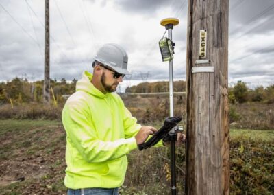
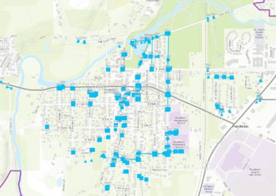
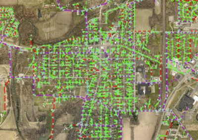
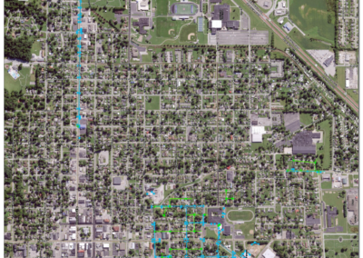
Have you ever had a late-night main break, but can’t find the shut-off valves? Is your senior operator about to move on or retire? Afraid his 30 years of system knowledge will go with him? These are two common examples of problems utility managers face. The solution has never been easier or more affordable. Mobile GIS mapping technology can revolutionize the way you run your utility. Banning offers map setup, training, GIS support and hosting services for a wide variety of utilities including Water, Wastewater, Storm, Gas and Electric. Using the latest in cloud-based Esri® Collector mapping technology, let Banning show you how we can:
- Map your system to the accuracy that’s appropriate for your system and budget
- Print reports for permitting agencies
- Link features like valves, power poles and manholes to photos, as-builts, and videos
- Securely host your map online for mobile device access
- Leverage viewing and collection apps for use on android and iOS devices
- Setup inspection layers for routine maintenance tracking
- Train your staff on collecting and managing the data
- Prepare your system for SRF funding eligibility
- Prepare GIS Standards for contractors so the financial burden of map additions is put on developers