(317) 707-3700 [email protected]
  • Facebook
  • RSS
  • Facebook
  • RSS
Banning Engineering
  • Home
  • About & History
    • About & History
    • Meet Our Team
    • News
  • Testimonials
    • Clients
    • Team Members
  • Careers
    • Benefits
    • Job Opportunities
    • Online Application
  • Markets
    • Construction Services
    • GIS Services
      • GIS Utility Mapping
      • GIS for Roads
      • GIS for Economic Development
      • GIS for Public Awareness
      • GIS Support
      • GIS Additional Services
    • Economic Development
    • Recreation and Quality of Life
    • Site Development
      • Site Development Commercial
      • Site Development Residential
    • Stormwater, Dams and Levees
    • Surveying
    • Transportation
    • Water & Wastewater
  • Civic Engagement
  • Contact
Select Page

Pendleton Safe Haven Baby Box

Sep 26, 2022 | Civic Engagement, Featured

Pendleton held their Annual Public Safety Day on Sunday, August 28th, and each year the Public Safety Day invites the community to see police, fire, and other emergency vehicles. Kids could operate the fire hose and even had the opportunity to dunk first responders in the dunk tank. The Kiwanis Club handed out free K-Burgers as well. Jeff Henson attended the event for Banning Engineering and commented on what a fantastic afternoon it had been!  

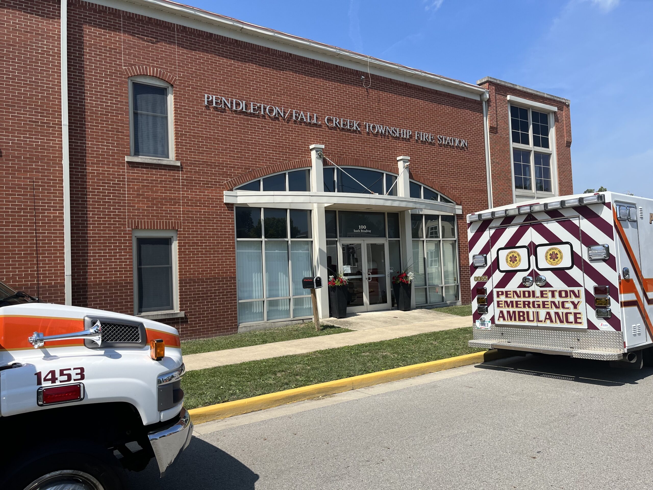
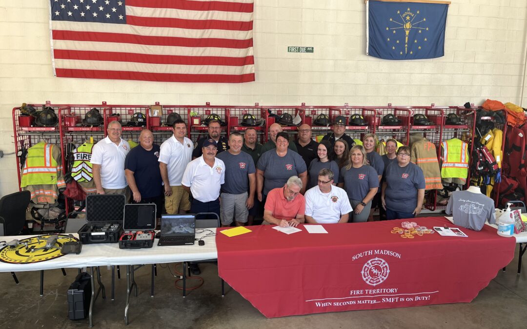
During the event, the Pendleton Town Council President, Chet Babb, and Pendleton Fire Chief, Chris Nodine, signed the official contract to install their community Safe Haven Baby Box. Having a Baby Box provides first responders and communities with a proactive method to eliminate illegal abandonment. The Safe Haven Baby Box takes the face-to-face interaction out of the surrender and protects the mother from being seen. Chet Babb, approached us, asking if we would contribute to this cause. Banning Engineering was honored to donate $2,500 to the Safe Haven Baby Box installation. The money raised for the Baby Box will go towards construction, the box, the security system, the annual fee, advertisements for the Pendleton box, and the 24/7 crisis hotline. We are thankful to partner with a community striving to create a safe and beautiful place for all. 

Safe Haven Baby Boxes’ mission is to prevent illegal abandonment of newborns by raising awareness, offering a 24-hour hotline for mothers in crisis, and offering the Safe Haven Baby Boxes for women who want to maintain complete anonymity. According to their website, there are over 100 Safe Haven Baby Boxes across the nation to assist in safe, legal, anonymous surrender of a newborn.  If you’re interested in learning more about Safe Haven Baby Boxes and the organization’s services, check out their website here. 

Categories

  • Civic Engagement
  • Commercial Site Development
  • Economic Development
  • Featured
  • From the Desk of Jeff Banning
  • GIS Services
  • Newsletter
  • Residential Site Development
  • Survey
  • Uncategorized
  • Wandering Indiana
  • Water & Wastewater

Recent Posts

  • Wandering Indiana ~ Spring Suggestions
  • Community Engagement ~ Plainfield-Guilford Township Public Library
  • From the Desk of ~ Jon Polson

BANNING ENGINEERING INC.

853 COLUMBIA ROAD

SUITE 101

PLAINFIELD, IN 46168

REACH US

[email protected]

(317) 707-3700

  • Facebook
  • RSS
Designed and Maintained by C2IT Consulting, Inc.
GIS Mapping for Easement Management

[vc_row][vc_column width=”2/3″][vc_column_text]Wouldn’t it be nice to quickly verify if your utility is within a recorded easement?  Banning offers a powerful solution for utilities and municipalities to manage their utility easements.  We leverage our land surveying staff to create an interactive web-based map showing all the easements across the utility territory.  The user can click on each easement to see details like instrument number, area, and even a picture of the recorded document.  This map can be made available to field personnel through Esri mobile applications for android and iOS devices.

[/vc_column_text][/vc_column][vc_column width=”1/3″][vc_single_image image=”327″ img_size=”full” alignment=”center” onclick=”img_link_large” img_link_target=”_blank”][/vc_column][/vc_row]

GIS for Marketing and Public Awareness

[vc_row][vc_column width=”3/4″][vc_column_text]Banning is in the business of helping clients meet their utility, facility, and economic development needs.  GIS plays a strong role in solving problems internal to the organization.  This same data can often be leveraged to promote, educate, and engage the public.  Banning provides services to host web-based maps, story maps, and even customized mobile apps for a variety of case uses.[/vc_column_text][/vc_column][vc_column width=”1/4″][vc_single_image image=”427″ img_size=”full” alignment=”center”][/vc_column][/vc_row]

GIS Support and Hosting Services

[vc_row][vc_column width=”2/3″][vc_column_text]At Banning, we are committed to developing a solution that works best for your organization.  Are you looking for a way to leverage your staff to collect utility data?  Banning provides services to set up your map templates, guide you on hardware, train your staff for efficient and accurate collection, and provide GIS support and hosting.  This approach is most effective in creating excellent maps even when budgets are limited.[/vc_column_text][/vc_column][vc_column width=”1/3″][vc_single_image image=”417″ img_size=”full” alignment=”center” onclick=”img_link_large” img_link_target=”_blank”][/vc_column][/vc_row]

Utility Asset Management

[vc_row][vc_column width=”2/3″][vc_column_text]Having an accurate system map empowers the utility manager to make data-driven decisions.  With data like pipe age, material, and size a water utility manager can start planning a pipe replacement program.  This approach is common but does not tell the whole story.  Banning engineers can use the GIS system data to quickly create a hydraulic model.  The hydraulic model is a powerful tool to show current system deficiencies as well as performance under future development flows.  This data allows the manager to make pinpoint improvements for the largest system benefit.  The resulting data, mapped in the GIS system, is a powerful visual to graphically show the short and long-term capital improvement plan for your utility.[/vc_column_text][/vc_column][vc_column width=”1/3″][vc_single_image image=”324″ img_size=”full” alignment=”center” onclick=”img_link_large” img_link_target=”_blank”][/vc_column][/vc_row]

GIS Mapping for Utilities

[vc_row][vc_column width=”2/3″][vc_column_text]Have you ever had a late-night main break, but can’t find the shut-off valves?  Is your senior operator about to move on or retire?  Afraid his 30 years of system knowledge will go with him?  These are two common examples of problems utility managers face.  The solution has never been easier or more affordable.  Mobile GIS mapping technology can revolutionize the way you run your utility.  Banning offers map setup, training, GIS support and hosting services for a wide variety of utilities including Water, Wastewater, Storm, Gas and Electric.  Using the latest in cloud-based Esri® Collector mapping technology, let Banning show you how we can:

  • Map your system to the accuracy that’s appropriate for your system and budget
  • Print reports for permitting agencies
  • Link features like valves, power poles and manholes to photos, as-builts, and videos
  • Securely host your map online for mobile device access
  • Leverage viewing and collection apps for use on android and iOS devices
  • Setup inspection layers for routine maintenance tracking
  • Train your staff on collecting and managing the data
  • Prepare your system for SRF funding eligibility
  • Prepare GIS Standards for contractors so the financial burden of map additions is put on developers

[/vc_column_text][/vc_column][vc_column width=”1/3″][vc_single_image image=”323″ img_size=”full” alignment=”center” onclick=”img_link_large” img_link_target=”_blank”][/vc_column][/vc_row]

GIS Maps for Parks

[vc_row][vc_column width=”2/3″][vc_column_text]Facility managers can bring the park inventory struggle to an end by creating an interactive park inventory map.  Feature like benches, playground equipment, or trash receptacles can be located, assessed for condition and photographed.  Adding a layer for an ADA accessibility assessment or for planning a long-term park improvement schedule can be very powerful.  These internal management tools can also be adapted to provide park information outside your organization to the community.  Story maps are a powerful way to educate and encourage park use.      [/vc_column_text][/vc_column][vc_column width=”1/3″][vc_single_image image=”325″ img_size=”full” alignment=”center” onclick=”img_link_large” img_link_target=”_blank”][/vc_column][/vc_row]

PASER Road Rating Maps

[vc_row][vc_column width=”2/3″][vc_column_text]Are you ready to get serious about managing your street network? Since 2016, the Community Crossings Matching Grant through INDOT has required an asset management plan.  Banning can create an interactive map of your street network with each segment color coded by PASER Pavement rating.  More powerful yet, showing multiple years of PASER data can show deterioration trends.  With this data, you can create a long-term capital improvement plan with a powerful visual to show the public and elected officials.[/vc_column_text][/vc_column][vc_column width=”1/3″][vc_single_image image=”326″ img_size=”full” alignment=”center” onclick=”img_link_large” img_link_target=”_blank”][/vc_column][/vc_row]

GIS Planning for Economic Development

[vc_row][vc_column][vc_column_text]Are you looking to give your community a competitive edge?  Draw attention from site selectors with the latest in interactive web maps, drone fly-over videos and 3D renderings for your developing community.   Banning can help create a web-based experience to highlight key features developers are looking for like available utilities, proximity to transportation routes, and topography of the site.[/vc_column_text][/vc_column][/vc_row]